
GPS Map Cam: Photo Location
Photography
2026-11-06
37.77MB
1.9.43
Android
482
Screenshots
Introduction
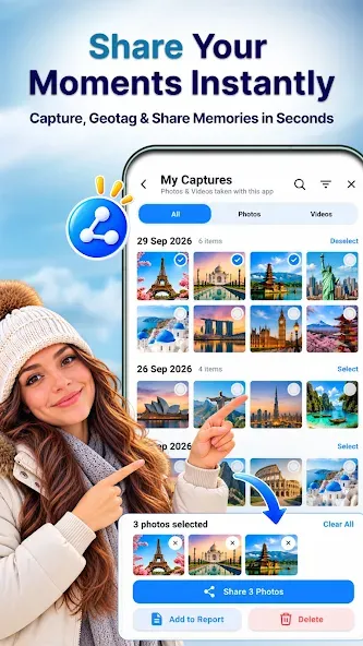
GPS Map Cam: Photo Location is a powerful camera application designed for geotagging. Featuring a clean, minimalist interface and intuitive controls, the app allows users to capture photos while automatically embedding detailed location data, timestamps, and dates. It also provides real-time updates on local weather conditions and relevant tags based on the user's current geographic location. The app ensures high-quality, crisp imagery, enabling users to produce professional-looking photos. It offers an extensive library of templates, allowing users to quickly select a style that suits their needs. Furthermore, the app includes robust customization options—users can manually configure coordinates and time zones, as well as add personal notes to their photos, making it easy to organize and manage their collection.
Features:
Location and Timestamps
Add latitude, longitude, address, date, time, time zone, and location accuracy data to your photos at the moment they are captured. You can choose between a full address or a concise version, depending on the level of detail required. Since this information is captured at the time of the shot, the recorded location and timestamp cannot be manually altered afterward.
Map Context for Every Image
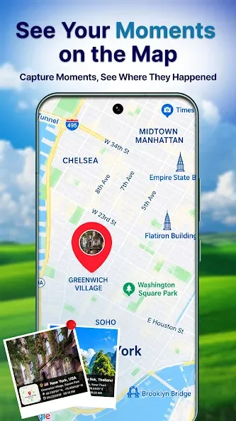
Embed a map into your photos to show the surrounding environment. The GPS Map Camera offers standard, satellite, terrain, and hybrid map views, with adjustable map scales to suit your needs. This feature is particularly useful when a text-based address alone is insufficient to clearly identify a specific location or checkpoint.
Flexible Stamp Templates
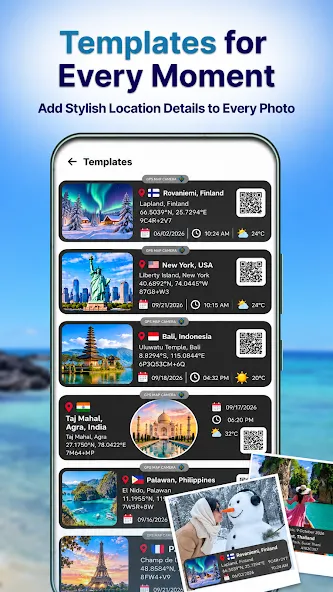
Choose from classic templates for basic GPS photo stamps, or opt for advanced templates that provide richer contextual information. Advanced options include custom codes, notes, tags, logos, weather details, compass direction, elevation, wind speed, humidity, atmospheric pressure, and magnetic field data. For instance, a real estate photo might only require an address and date, whereas a field report might necessitate a more comprehensive record.
Stamp Layout Controls
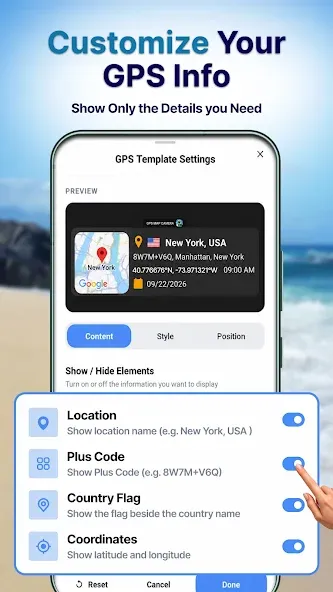
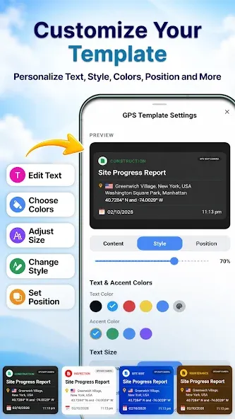
Customize the font, color, size, position, and specific fields displayed in your stamps. The app supports both decimal coordinates and degrees-minutes-seconds (DMS) formats, allowing you to align with the standards used by your project or team. Displaying only the essential fields keeps photos clean and uncluttered, while detailed layouts are ideal for audits and progress reporting.
Camera and Recording Tools
The app includes features such as grid lines, aspect ratio settings, flash control, focus, a timer, scene modes, filters, and support for the front-facing camera. After capturing an image, you can utilize automatic file naming, select a destination folder, and browse your photos on a map. Furthermore, the app can generate image-based or PDF reports—including "before-and-after" comparisons—and provides QR code-based navigation to previously saved locations.
Highlights:
Capture Photos with Real-Time Location Data
This app allows you to capture photos embedded with real-time GPS location data—including latitude and longitude, full address (street, city, country/region), and a date/time stamp. Never forget where a photo was taken again. Each image also includes a map preview, providing a complete overview of the location.
Add Maps and Location Stamps to Your Photos
Enhance your photos with map overlays and location stamps. Choose from various map styles, such as satellite, standard, or hybrid views. The app automatically adds location tags and lets you adjust the layout, positioning, and design for a more professional look.
GPS-Enabled Camera
Enjoy the convenience of a built-in GPS camera. Capture high-quality photos that are automatically tagged with location data—perfect for engineers, travelers, bloggers, and field personnel.
Versatile Use with Extensive Customization Options
The GPS Map Camera is ideal for travel photography, construction site documentation, proof of delivery, real estate, outdoor activities, and business records. It helps you precisely track where and when every photo was taken.
Personalize your experience by customizing timestamp formats, map styles, text layouts, and designs—you can even add notes to your photos.
Simple, Smooth, and Secure
Experience a camera that’s ready to go with a single tap. It automatically detects your GPS location without the need for complex setup. The app is lightweight and runs smoothly on any device. Your privacy is fully protected; location data is used exclusively for your photo information and is never shared without your permission.
FAQS:
How does GPS Map Cam: Photo Location handle privacy settings?
The software respects user privacy, allowing you to enable or disable location access for specific sessions. You have full control over which photos contain embedded metadata before sharing them with others.
Is GPS Map Cam: Photo Location compatible with various social media platforms?
Yes; the generated images are standard high-resolution files that can be uploaded to any social platform. The embedded data remains visible as part of the image, providing your audience with clear contextual information.
Does this tool consume an excessive amount of battery power?
The system is optimized for power efficiency; however, continuous use of GPS will naturally affect battery drain. For extended battery life during intensive fieldwork, it is recommended to use the tool in short, targeted bursts.
Advantages and disadvantages:
Pros
Automatically adds GPS data to photos
Displays images on an interactive GPS map
Includes advanced camera settings
Cons
Relies on third-party apps for full functionality
Conclusion:
Want to preserve your travel memories or photos from specific locations? With the GPS Map Cam: Photo Location app, you can add details to your photos—such as date and time, a live map, latitude, longitude, weather, magnetic field data, compass direction, and altitude. GPS Map Cam: Photo Location is an essential tool for documenting and sharing your travel experiences.




-
Latest Updates
-
Featured Apps