GPS Map Camera
Photography
2026-09-05
52.65MB
1.9.34
Android 6.0+
407
Screenshots
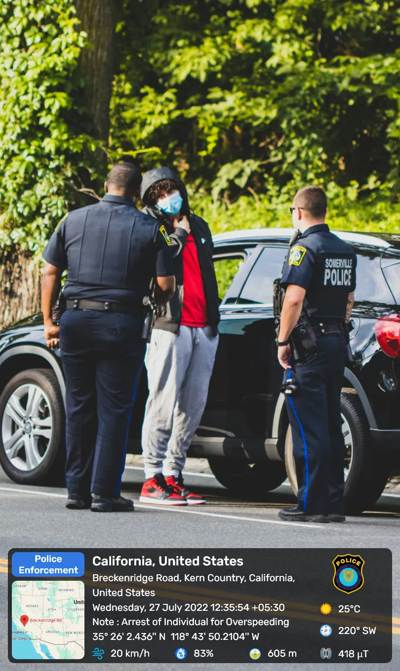
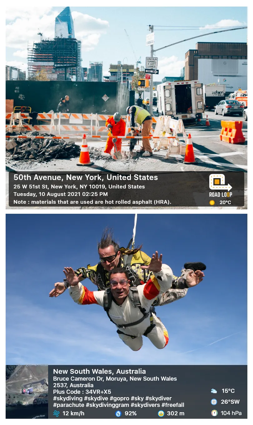
Introduction
GPS Map Camera is a powerful camera tool that allows users to add complete address, date, and latitude/longitude information to their photos. It also features an automatic function; simply turn on location services, and it will automatically fill in local weather and time information. The app provides real-time GPS maps, allowing users to quickly understand the background information of images. Furthermore, it offers rich customization options, allowing users to adjust photo font styles, colors, and data markers, helping users create professional-grade travel photos.
Features:
Location, date, and time stamps
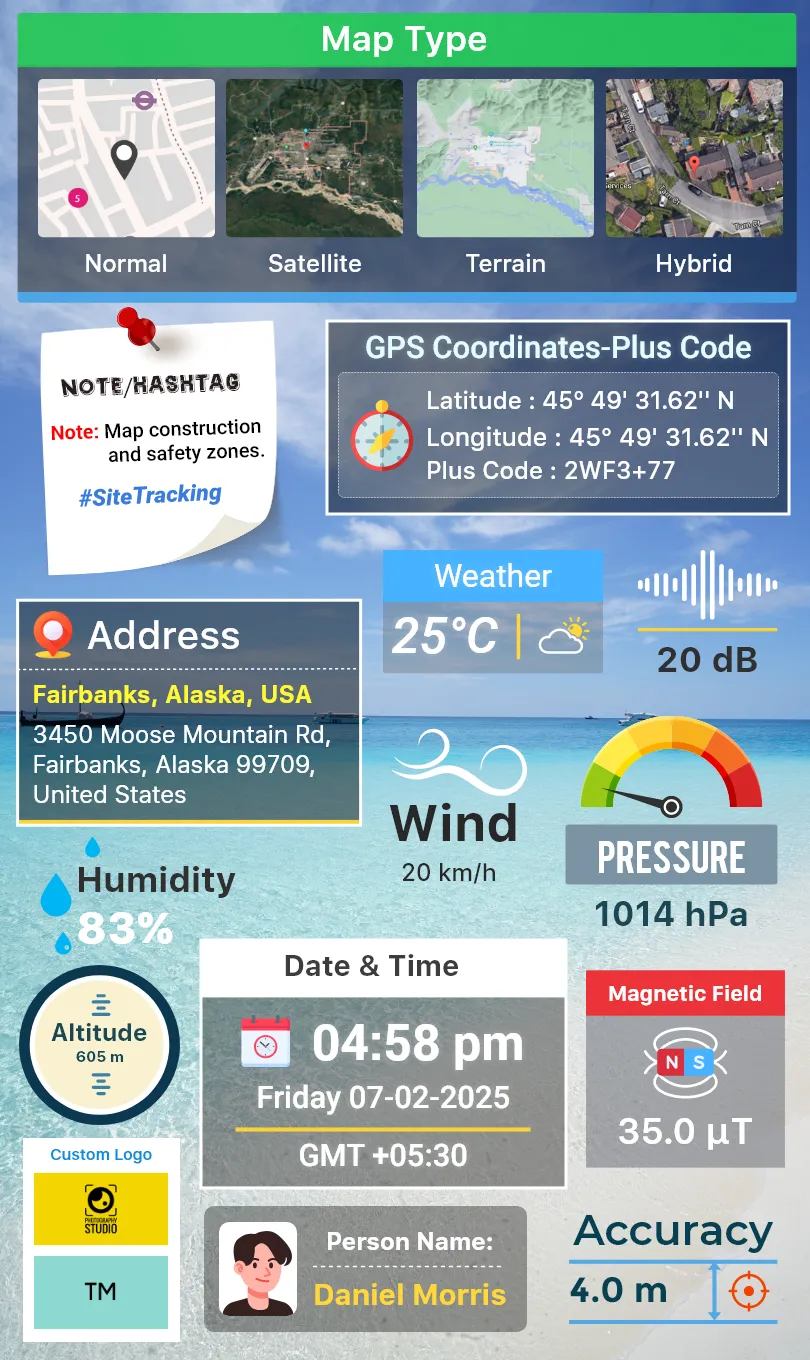
GPS Map Camera adds latitude and longitude, short or full address, date, time, and timezone to each photo. You can choose coordinates in decimal or DMS and switch between auto and manual address entry. If you shoot indoors, wait for a stable signal so that accuracy and weather fields update correctly.
Map overlays on photos
You can place a live map slice on images for quick context. Pick Normal, Satellite, Terrain, or Hybrid views to match the scene. When a shot feels crowded, reduce fields to essentials like coordinates and time to keep photos clear.
Flexible templates and rich context
Classic template auto fetches core location and time.
The advanced template lets you add Plus Code, notes, hashtags, and a logo.
Set weather units in Celsius or Fahrenheit and toggle sensors like compass, magnetic field, wind, humidity, pressure, altitude, and accuracy.
Camera tools and an organized gallery
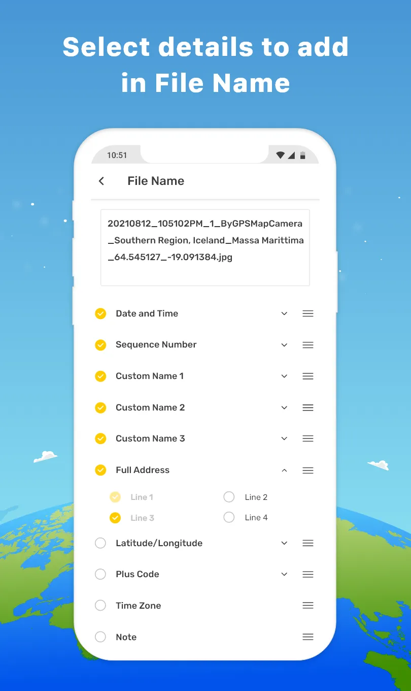
You get grid, aspect ratios, front or rear camera, flash, focus, mirror, timer, capture sound, scene modes, and filters for steady shooting. A map gallery pins images to locations and auto file naming keeps photos sorted. A built-in QR scanner helps during visits. For best results, confirm you are using the GPS Map Camera latest version before field work.
Highlights:
Seamless Geotagging Technology
The core functionality of this utility revolves around its ability to overlay comprehensive metadata onto images without manual intervention. Users can customize the layout of the geographic information, choosing between various map styles, coordinates, and weather details that appear directly on the frame. This capability is particularly useful for professionals who must provide visual evidence of site visits or project progress in specific locations.
Enhanced Visual Documentation
Beyond simple data embedding, the software offers a robust set of customization options to ensure that the information remains legible and aesthetically pleasing. You can adjust font styles, colors, and the positioning of data stamps to suit different lighting conditions or backgrounds. This level of flexibility makes GPS Map Camera a versatile choice for anyone looking to create professional-grade logs of their journeys or fieldwork.
Intuitive User Interface
Navigating through the settings and capturing images feels fluid thanks to a clean, minimalist design that prioritizes ease of use. The interface allows for quick toggling between different data types, ensuring that you only display the information relevant to your current task. By removing unnecessary clutter, this solution enables you to focus entirely on the subject matter while the background processes handle the technical details of location tracking.
Reliable Offline Functionality
One of the most impressive aspects of this tool is its ability to maintain high levels of accuracy even when mobile data is limited or unavailable. By utilizing internal sensors and offline cached maps, the system continues to record precise location data during remote expeditions or hiking trips. This reliability ensures that your documentation remains consistent and trustworthy regardless of your connectivity status in challenging environments.
Pros and Cons:
Pros
Extensive customization abilities
Provides comprehensive geodata
Has a built-in camera with high-functioning features
Cons
Camera can run into zoom and focus issues
App takes up a good amount of battery life
Ads can block parts of the app
FAQs:
Q. Can I use GPS Map Camera without an internet connection?
A. GPS Map Camera works offline as it utilizes your device's built-in GPS sensor to capture location data.
Q. Does the app drain my device's battery quickly?
A. GPS Map Camera is designed to be efficient, but continuous use of the GPS feature may consume more battery. It is advisable to have sufficient battery backup while using the app extensively.
Q. Can I customize the appearance of the watermarks?
A. Yes, the app allows you to customize the font, size, color, and position of the watermarks according to your preference.
Q. Is it possible to share my geotagged photos on social media platforms?
A. GPS Map Camera integrates with various social media platforms and messaging apps, making sharing your geotagged photos with friends and family easy.
Q. Can I edit the geotag information after capturing a photo?
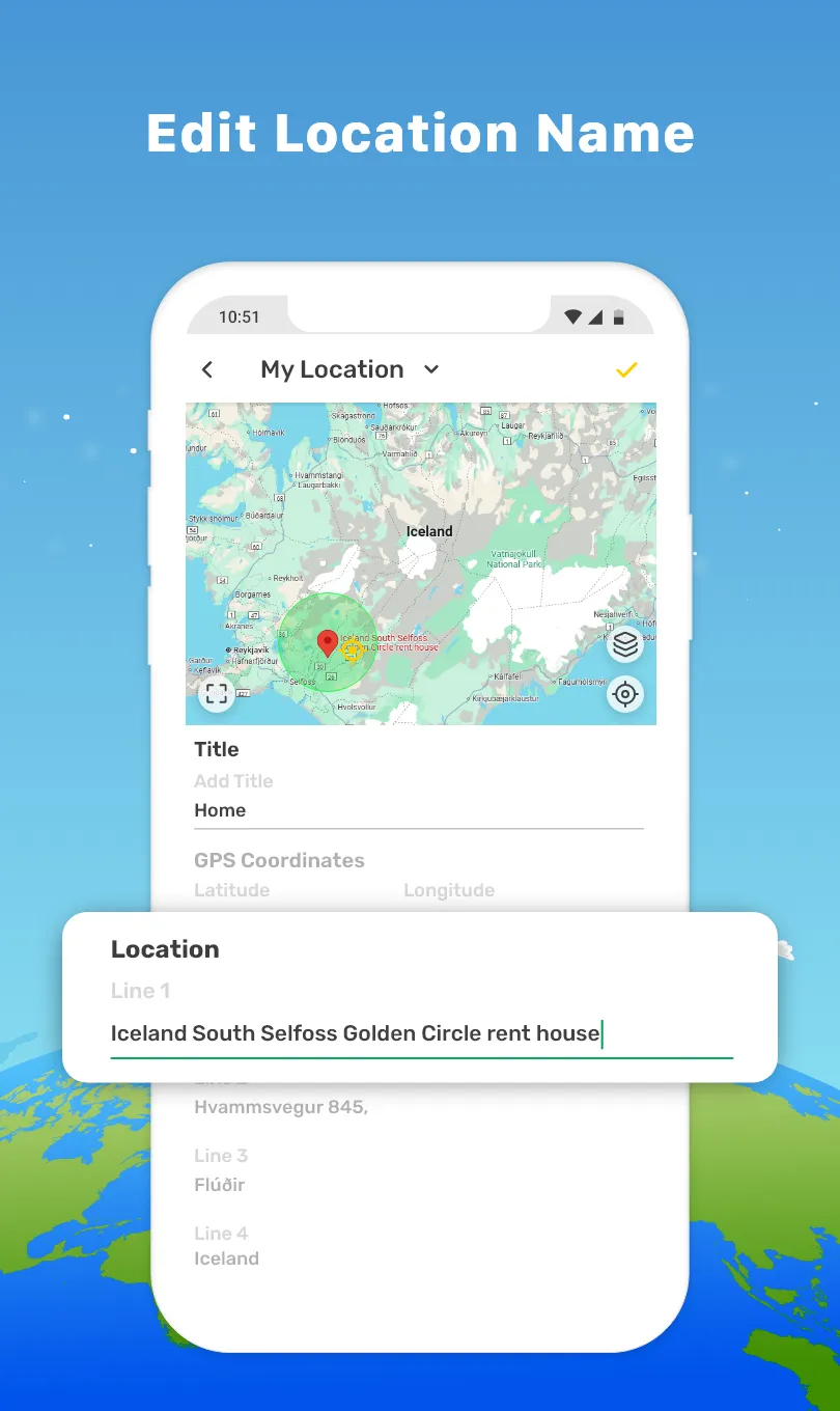
A. GPS Map Camera allows you to edit the geotag information manually if needed. You can modify the location coordinates, address, and other details.
Conclusion:
Incorporating various features such as customizable map options, detailed weather data, and the ability to add personal notes, the GPS Map Camera app provides a comprehensive solution for anyone looking to enrich their photography experience. From travelers documenting their adventures to professionals needing precise location information, this app delivers the tools necessary to create meaningful and contextually rich images.
-
Latest Updates
-
Featured Apps